Ultrafine Location Fixes
Small ground-based transmitters that mimic GPS satellites help receivers find their position with high accuracy.
The GPS technology that allows cell phones and other devices to pinpoint their location to within a few meters has made possible new services ranging from location-aware social networks to self-driving cars. A new location technology accurate to a few centimeters will refine those services and unlock another wave of novel ideas, claims Australian company Locata. The company’s technology can work alongside GPS to provide superaccurate positioning or fill in the gaps in places where GPS signals are blocked.
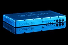
Locata’s technology involves installing a network of “LocataLites”–devices about the size of a hardback book–in several known locations across an area. These devices function like grounded versions of GPS satellites, sending out signals that receivers use to get a location fix. LocataLites transmit signals using the same frequency as Wi-Fi, and they can each cover several kilometers. “We introduce a local constellation that works like the one in space,” says Nunzio Gambale, one of Locata’s two cofounders. “It’s just much cheaper and more accurate.”
The technology will be used to track aircraft on the U.S. Air Force’s White Sands Missile Range in New Mexico, where an upgraded system will soon cover an area of 6,474 square kilometers. The Boddington gold mine in Western Australia is using Locata’s technology to position digging and drilling equipment with high accuracy. It is a convenient alternative to manually surveying the insides of the deep opencast mine, the walls of which block GPS signals. The same effect often weakens or blocks GPS signals in urban environments. Locata’s technology is also attractive for any city wanting to offer its own “location hotspot” to fix that, says Gambale.
Next month, Locata will release information that will allow other companies to manufacture receivers, a move intended to see the technology added to devices that already use GPS signals. “It’s like the early days of GPS,” says Gambale. “The real explosion will happen when there are chip-scale receivers that can fit into your pocket.”
Ultimately, this could mean smart phones that know their location with remarkable accuracy, enabling apps such as augmented reality to be much more powerful. Before that, however, construction sites, warehouses, and factories will likely benefit. Tracking goods and machines with high accuracy can enable greater use of robotics and automation, says Gambale.
Locata’s technology was enabled by a cheaper alternative to the atomic clock found inside every GPS satellite. Each satellite uses its clock to timestamp the signal it sends back to Earth. A receiver can use that timestamp to calculate its distance from a satellite, based on the time it took for the signal to travel. Repeating this trick with several satellites reveals a gadget’s position through triangulation.
Locata’s satellite mimics are built with timing chips much less accurate than an atomic clock. That’s possible because they only keep in sync with one another, not to an external standard, says Gambale. LocataLites do this by listening to each other’s signals. Each LocataLite adjusts the timing of its outgoing signal based on the timing of the signals it picks up from other LocataLites, creating a feedback loop that ensures all the signals are in sync. “All the clocks drift together,” says Gambale, and all the signals are synchronized to within two nanoseconds.
“Synchronizing this kind of device is a big research task,” says Per Enge, professor and leader of the GPS research lab at Stanford University. His group is working on similar devices known as pseudolites that will be deployed across the U.S. by the Federal Aviation Authority to boost the reliability of GPS and to protect signals against jamming or natural interference. The goal is to make it possible for civilian aircraft to rely on GPS more heavily so they can use more sophisticated autopilots that help cut fuel use.
Enge says it is likely that these pseudolites will rely on time signals sent over the Internet, using a new protocol that enables high accuracy. Some may tune in to time signals broadcast by Iridium communications satellites, which are in lower orbits than GPS satellites and so yield stronger signals back on Earth.
Locata’s approach of using feedback among its devices sounds “valid,” Enge says, although those at the edge of a network might be more likely to lose their timing if they cannot correlate with as many of their fellows as those nearer the center.
Gambale hopes Locata’s technology could also aid aviation, and he says he has conducted test flights in Australia using the technology. However, civil aviation adopts new technology very cautiously due to the need for absolute safety. “Locata will make their money from construction and agriculture,” says Enge.
