Connectivity
Build a 3-D Virtual World with This Crowdsourced Map of the Real World
Mapillary is stitching together user-submitted photos to create an ever-changing 3-D map of the planet.
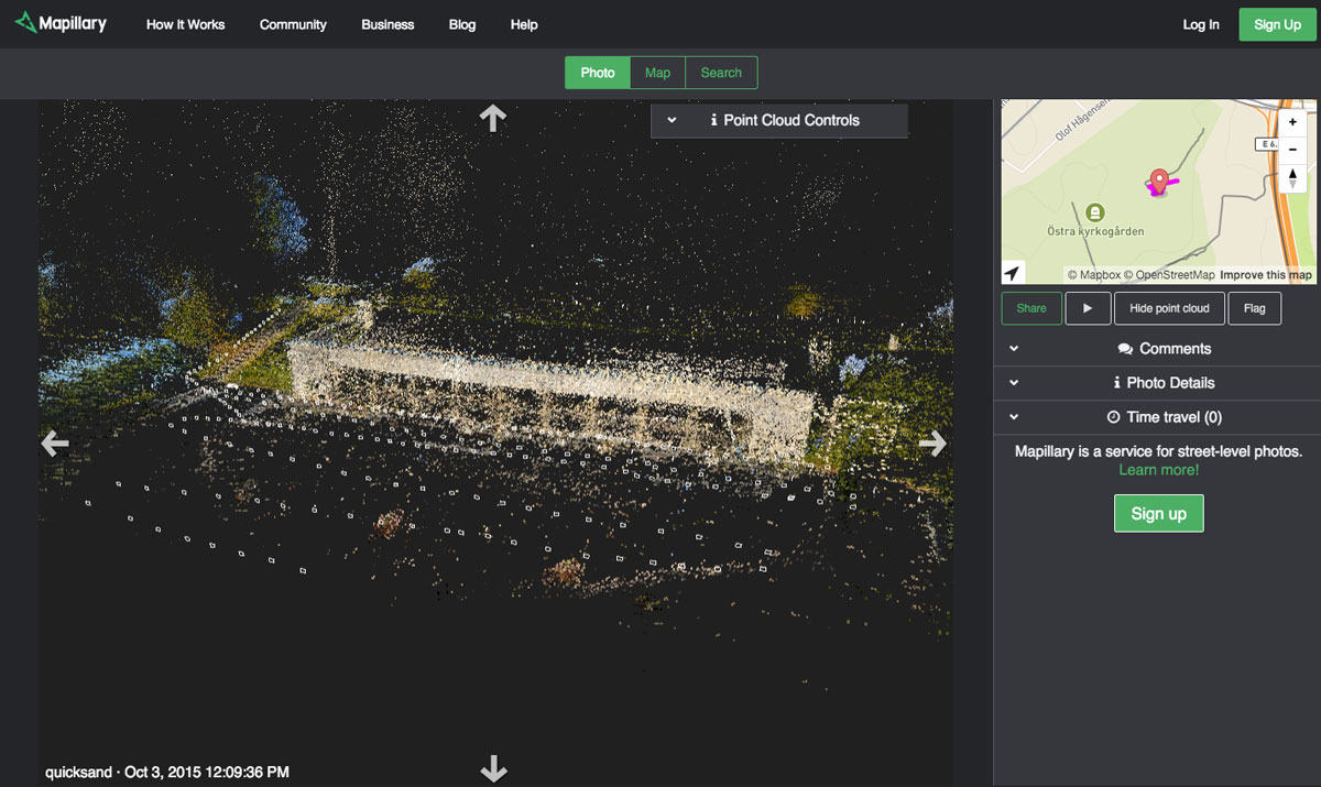
Crowdsourced map startup Mapillary is letting users view images they upload in 3-D. Here, the company’s viewer gives a sense of how it fits those images together.
A crowdsourced mapping startup is using computer-vision technology to turn user-submitted photographs into a searchable, 3-D map of the world.
Swedish startup Mapillary, which launched its free smartphone app in 2014, offers an alternative to Google Street View made entirely from crowdsourced photographs that users upload with their smartphones. You can browse these images by clicking through city streets and pedestrian spaces to get a first-person view of the surroundings.
And now you can use the phone app to also peer around obstacles and pan down to see a 3-D, bird’s-eye view, since Mapillary made changes that transform the more than 40 million photographs in its database into 3-D spaces.
Usually a 3-D model is created from a complete batch of photographs, and highly detailed reconstructions of a city can take weeks or months to compute, says Mapillary CEO Jan Erik Solem. But Mapillary doesn’t start with a full set of pictures because new images trickle in constantly, and the startup needed a way to integrate them piece by piece, quickly, and on a budget.
To solve this problem, the startup treats its 3-D world as a series of small blocks. When a new image is loaded into the database, Mapillary determines where it belongs in the virtual world and then reconstructs only a small block with the fresh image.
The company gives a sense of how the 3-D scenes are stitched together with a new viewer it’s adding to its app and website. A computer-vision system matches common elements in photographs to accurately combine them, and the viewer shows a thin rectangle to indicate the placement of each user-submitted photograph, plus a series of points that represent an important piece of visual data chosen by the computer.
Mapillary uses computer vision to make its growing 3-D map of the world searchable. The system classifies objects and text so users can find them with a word search. As Google Street View does, it automatically blurs license plates and faces.
Mapillary hopes the addition of 3-D visualizations will help it continue growing its photographic database, to which anyone can contribute via a mobile phone. While Mapillary has mapped just a fraction of the area covered by Google Street View, Mapillary’s app covers local places that are difficult to reach with a fleet of cars, as Google usually uses.
Solem is particularly looking forward to seeing maps of specific places evolve, which is possible because Mapillary allows users to click back in time—a capability he refers to as “time traveling.”
“That feature, given a few more years, will be very, very cool,” Solem says.
