A team from NASA has created maps using satellite data that show the areas most damaged by the ongoing Woolsey and Camp wildfires, the deadliest in the state’s history.
The fires: There are currently 228 people missing and 42 dead, making the Camp fire in the north even more lethal than the Griffith Park disaster of 1933. It has virtually destroyed the town of Paradise. The Woolsey fire in the south has so far killed two people and damaged a number of beach resorts. More than 300,000 California residents have had to flee their homes.
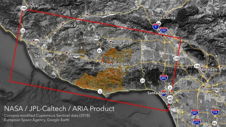
The maps: NASA’s Advanced Rapid Imaging and Analysis team has created maps to show the areas most likely to be damaged by the fires. The team used synthetic aperture radar images taken by the European Space Agency’s Copernicus Sentinel-1 satellites, which orbit from a height of 693 kilometers.
What they show: The map above shows the extent of the Woolsey fire in Southern California as of November 11, covering an area of 50 by 25 miles. The color variation from yellow to red indicates ground surface damage. The maps are meant to help first responders identify the areas that need help the most and prioritize how they allocate resources. It’s not the first time NASA satellite data has been used for this purpose, but it may be the most urgent.