
Space
The number of satellites orbiting Earth could quintuple in the next decade
The coming explosion of constellations

As you read this there are about 2,000 satellites orbiting above our heads, and apart from an occasional glimpse in the night sky, they’re pretty much invisible. But they have become a huge part of everyday life on Earth. Want to find your way around? Tap a button and your phone talks to a constellation of GPS satellites. Those stunning images of Arctic sea ice and animations of ocean-churning hurricanes? Satellite-based, of course. These days, the view from orbit is so ubiquitous that most of us have probably forgotten a time when it wasn’t part of our perspective.
Over the next few years, there’s going to be even more hustle and bustle in orbit. By 2025 as many as 1,100 satellites could be launching each year—up from 365 in 2018. Just one project, SpaceX’s ambitious Starlink, aims to fly 12,000 small satellites by 2027. It and similar projects aren’t just crowding the skies—they’re delivering a host of technological upgrades meant to improve life planetside.
Bird’s-eye views
From mapping the planet in minute detail to simply making sure a smartphone user doesn’t get lost, satellites do a little bit of everything. And they work better in groups. These four satellite constellations each perform a synchronized function without which your life wouldn’t be—or soon won’t be—the same.
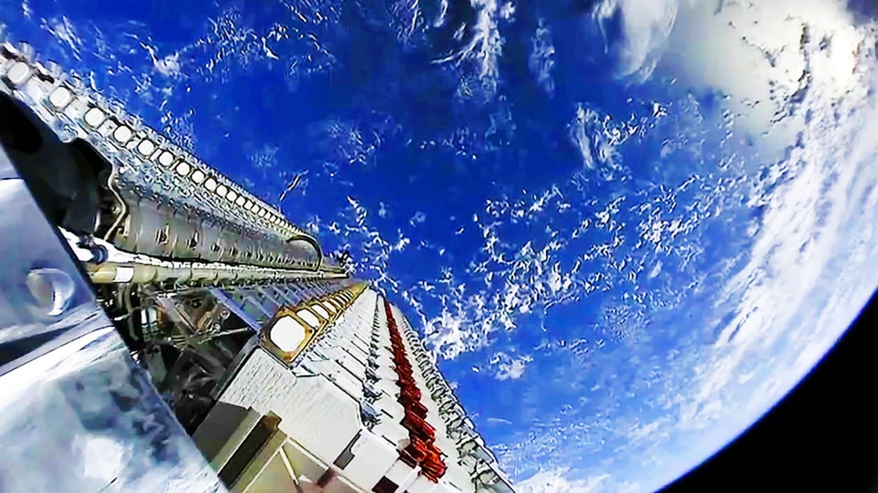
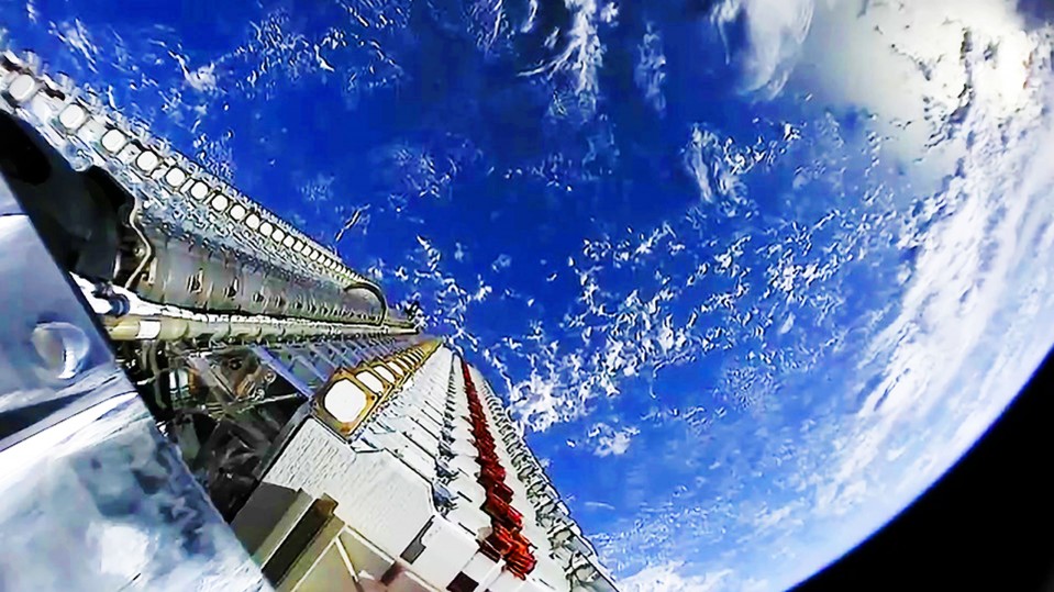
Internet access: Starlink
- Number of satellites: 60 launched; ~12,000 planned
- Manufacturer: SpaceX
- Launch dates: 2019–2027
Starlink is one of several projects aiming to create low-cost, high-speed global satellite internet that can compete with terrestrial networks while connecting far-flung rural communities. The satellites will be deployed at three different altitudes within low Earth orbit. At a little over 200 kilograms apiece, they’re relatively small as satellites go, but each batch of 60 offers up to 1 terabit per second of bandwidth, enough to stream 4K video to about 40,000 people simultaneously.
Weather monitoring: GOES-R
- Number of satellites: 2 launched; 4 planned
- Manufacturer: Lockheed Martin and Harris
- Launch dates: 2016–2024
Weather forecasting isn’t just an addendum to the evening news: better predictions of severe weather can save thousands of lives. New machines sitting over the equator in geostationary orbit are pushing forecasts to the next level. In 2016, the GOES-R satellite program started monitoring clouds and water vapor using reflected solar radiation. This is different from ground-based radar methods, which send signals into the sky and analyze the returns. Two GOES (for “geostationary operational environmental satellite”) satellites have launched so far. Using onboard instruments like the Geostationary Lightning Mapper and the Advanced Baseline Imager, which collects images in 16 channels of visible, near-infrared, and infrared light, the satellites have already improved forecast lead times. The next satellite in the series, GOES-T, has had some setbacks, but all four GOES satellites are expected to be up and running by 2024.
Earth observation: Dove
- Number of satellites: 351 launched; 120 active
- Manufacturer: Planet Labs
- Launch dates: Started 2013; ongoing
While many constellations of small satellites are in the works, startup Planet Labs has one already up and running. Manufactured in house, Planet’s Dove satellites image the entire planet every day. The Doves, which have a life span of two to three years, are cubesats—small, boxy satellites weighing a few kilograms each that can be packed into a rocket and launched in batches. In 2017, the company set a record for the largest one-time deployment when it sent 88 Doves into orbit. Each Dove can take two high-resolution pictures of Earth’s surface per second, compiled into a continuously updated, searchable archive. Many of Planet Labs’ clients already rely on the images for tasks such as monitoring crop growth and health, providing military intelligence, and detecting illegal deforestation.
Positioning: GPS III
- Number of satellites: 1 launched; up to 32 planned
- Manufacturer: Lockheed Martin
- Launch dates: 2018; ongoing
GPS has been around since the 1970s in military applications. But in 2000, Bill Clinton authorized an end to “selective availability,” handing civilians access to more powerful GPS signals. Now it helps do everything from guiding tractors in fields to locating your nearest coffee shop. The GPS III satellites are the newest and best version: Lockheed Martin claims they are three times more accurate, and more resistant to malicious or accidental jamming. They can also collaborate with other positioning satellites to help give users better reception inside buildings and under tree cover. After years of delays, only one GPS III satellite has launched so far. To complete the “A block” of the constellation, nine more are scheduled to launch by 2023.