Intelligent Machines
Predictions for the 2009 Hurricane Season
NASA satellites are providing data used to forecast this year’s hurricanes. So far the news is good.
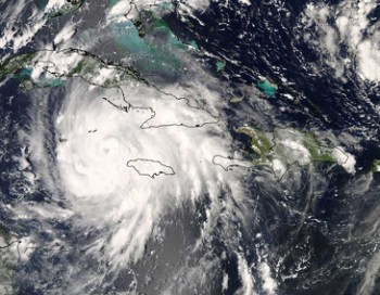
While the start of summer mostly brings warm weather and sunny skies, it also marks the start of the Atlantic hurricane season, which officially begins June 1 and lasts until November 30. (For the Pacific Ocean, hurricane season starts on May 15.) This year, NASA is using, as it has in the past, its orbiting satellites to study and research tropical cyclones, and it will provide the data that the National Oceanic and Atmospheric Administration (NOAA) National Hurricane Center uses in advanced models and hurricane predictions.
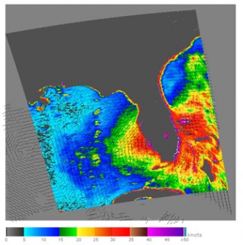
So far, the news is good. The satellites, which measure such things as storm and surface winds, sea-surface heights and temperatures, rainfall intensity, lightning, water vapor, humidity, cloud development, and atmospheric pressure, indicate that sea-surface temperatures in the tropical Atlantic are below normal. Such lower-than-normal temperatures could “starve” developing hurricanes of their driving force–waters warmer than 80 °F–meaning fewer hurricanes.
Despite the good news, peak hurricane season is not until late summer and early fall, and NASA’s William Patzert says that oceanic and atmospheric conditions can change dramatically. “You can be clobbered no matter what the expert outlook is today,” he says. People need to remain prepared.